Mission
1. Context
In a warming climate (IPCC 2023), the frequency and intensity of precipitation are projected to increase globally, including at high latitudes. Precipitation is defined as all forms of water, liquid or solid, that fall from the atmosphere to the Earth’s surface, such as rain, snow, sleet, hail, and drizzle. The Arctic region, typically defined as the area north of 66°33’N, is particularly sensitive to these changes, as increased rainfall
can accelerate surface melt and contribute to ice sheet destabilization. Accurately quantifying precipitation in these regions is therefore essential to improve our understanding of ice sheet mass balance, its decline, and the associated impacts on sea level rise. Satellite-based radar observations, such as those from the CloudSat mission, have been effective in detecting and characterizing precipitation at high latitudes, although challenges remain due to the complexity of snow–rain transitions and the lack of ground-based data.
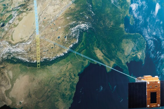
The EarthCare satellite, launched in May 2024 through a European–Japanese partnership, is expected to overcome some of these limitations by providing new observations that will better our understanding of high-latitude precipitation processes. For this PhD we would be using the Cloud Profiling Radar (CPR) onboard EarthCare that provides vertical profile measurements of clouds and observes vertical velocities of cloud particles through Doppler measurements together with ATLID lidar and BBR radiometer. The work will benefit from an ongoing collaboration between Prof. Kenta Suzuki (Univ. Tokyo) and Prof H. Chepfer (Sorbonne Université).
2 Objectives and scientific approach
Climate models predict an intensification of high-latitude precipitation under global warming scenarios (Lau, Wu, and Kim 2013), thus we can expect an increase in the frequency of rainfall. A recent paper by (Thompson-Munson et al. 2025) supports these projections, providing further evidence of a clear relationship between surface temperature rise and the proportion of rainfall, with the number of precipitation
events doubling with 2.3°C of warming. Accurate quantification of rainfall frequency, along with analysis of snow–rain phase transitions using near-surface air temperature and pressure, is essential to improve our understanding and climate projections in these regions. Despite numerous studies, both models and satellite observations continue to face limitations in high-latitude environments due to sparse ground-based
measurements. Intercomparisons between satellite, model, and reanalysis datasets (Behrangi, Christensen, et al. 2016) have shown that radar-based satellite observations are very effective for monitoring precipitation. Satellite CloudSat has been traditionally used to study the Arctic but despite very important and physically
coherent results it still suffers from known biases such as the tendency to overestimate precipitation over Greenland due to difficulties in identifying mixed-phase hydrometeors. The EarthCARE satellite, launched in 2024, is equipped with the first spaceborne Doppler cloud radar, enabling vertical profiling of clouds and
measurement of hydrometeor fall velocities. Its Cloud Profiling Radar (CPR) provides high-resolution and high-sensitivity observations capable of detecting light precipitation and identifying melting layers. Combined with lidar and multispectral imaging instruments, EarthCARE enables the detailed characterization of cloud microphysics and precipitation phase transitions. This study will use EarthCARE data to retrieve and classify precipitation over the Arctic, with a focus on Greenland, hoping to overcome the previous limitation of the region of study.
Climate models contain large biases in precipitation (G. L. Stephens et al. 2010), and observational precipitation products contain large uncertainties (Behrangi, Lebsock, et al. 2012), this highlight the need for improved observational constraints.The student will analyze Cloud Profiling Radar (CPR) data from EarthCARE to characterize precipitation, focusing on radar reflectivity (Ze, in dBZ), Doppler velocity,
precipitation occurrence, and precipitation rate, which are either directly measured or retrieved using radar- based retrieval algorithms. By combining this with co-located surface temperature profiles, the project will quantify the snow-to-rain transition in function of different near surface air temperature to link the precipitation with surface temperature warming. We will compare our newly obtained precipitation results
from EarthCare retrievals to the same parameters in the global circulation model LMDZ and the global cloud-resolving model NICAM. This approach will help refine climate model parameterizations and improve future projections of precipitation and surface melt in polar regions.
=================
For more Information about the topics and the co-financial partner (found by the lab!); contact Directeur de thèse - chepfer@lmd.ipsl.fr
Then, prepare a resume, a recent transcript and a reference letter from your M2 supervisor/ engineering school director and you will be ready to apply online before March 13th, 2026 Midnight Paris time!
Profile
Laboratoire
MESSAGE from Phd Team
More details on CNES website : https://cnes.fr/fr/theses-post-doctorats