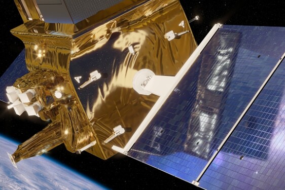
Mission
Land surface temperature (LST) is a key variable in urban microclimatology studies. Upcoming thermal infrared (TIR) satellite missions such as LSTM (ESA), TRISHNA (CNES/ISRO) and SBG (NASA), will enable unprecedented investigation of the urban heat island effect. These missions will provide multiple images per week, acquired at various angles, with ground resolutions of 50-60 m. This will overcome the current limitation of having to choose between high spatial or high temporal resolution when studying urban microclimatic phenomena. At these resolutions, the nature and three-dimensional (3D) structure of the urban surface can significantly impact the directionality of the measured temperatures. Therefore, to generate accurate LST products that are comparable regardless of the viewing angle, it is necessary to have a good understanding of these effects.
LST is typically obtained through remote sensing of emitted thermal radiation. However, the 3D structure of cities can complicate observations due to non-uniform solar heating of urban surfaces, which induces anisotropy in surface thermal emission at a local scale. Consequently, the remotely sensed urban LST varies with the viewing angle of the sensor. These variations can be extremely large, estimated to range from 5 to 7 K, and even up to 10 K, during an airborne campaign over Toulouse (Lagouarde et al., 2010).
Models have been developed to understand this directional behaviour and to normalise the brightness temperature to standard observation geometry at the city scale. Lagouarde et al. (2010, 2012) modelled these directional effects over large urban areas using the Solene-Microclimat and TEB (Town Energy Balance) radiative transfer tools. More recently, Krayenhoff and Voogt (2016) obtained similar results using TUF3D and SUM on highly simplified urban landscapes. These studies showed that the anisotropy strongly depends on urban morphology, including orientation, building shape, and the height/distance ratio. These studies focused on urban scenes at the city scale. More recently, Zheng et al. (2020) evaluated the directional effects at the canyon scale, showing that a difference of 4.2 K could be reached between a canyon assimilated to flat ground and the real 3D structure for a facade temperature of 340 K.
Previous studies have highlighted the need to correct TIR measurements for directional effects in urban environments, but these studies are not suited to the spatial resolution of LSTM, TRISHNA or SBG. This PhD therefore aims to investigate the impact of directional effects induced by urban 3D structures on LSTs retrieved at the scale of future TIR satellite missions. The objective is to identify the main driving parameters by modelling and quantifying these effects for different urban configurations (e.g. building structure, orientation and composition) using radiative transfer tools adapted to structured 3D environments. This should result in the creation of a semi-physical directional model that can correct for these effects and normalise data acquired under different viewing and illumination conditions. Synthetic and real data from field campaigns, such as CAPITOUL (Lagouarde et al., 2008), will be used for validation purposes.
This research builds on a recent analysis of CAPITOUL's airborne TIR data. This analysis highlighted significant directional effects (up to 4.8 K) at the TRISHNA scale (60 m), and confirmed the need to account for angular dependencies in future LST products. Further research combining airborne acquisitions with modelling approaches is required to investigate directional effects and finally develop a normalisation approach considering the impact of surface geomorphological characteristics across a wide range of urban landscapes and angular configurations.
Research plan:
• Providing an updated state of the art on the quantification of directional effects on radiative surface temperature measurements and their modelling in urban environments, along with the analysis of the main classes of urban structures (morphology, material type...)
• Modelling the directional effects on temperature for different 3D urban configurations, and conducting a sensitivity analysis to determine the main driving parameters explaining these effects at the LSTM, TRISHNA and SBG scales using radiative transfer tools adapted to a structured 3D environment. The latter will be defined by urban patterns derived from city morphology at 60 m
• Development of a semi-physical directional model based on the results of the previous step to correct for directional effects and perform an angular normalisation of the temperature
• Validation of the proposed model using existing airborne datasets acquired at different viewing angles. As the TRISHNA mission is scheduled for launch in 2027, newly acquired satellite data may be processed during the PhD thesis.
=================
For more Information about the topics and the co-financial partner (found by the lab!); contact Directeur de thèse - laure.roupioz@onera.fr
Then, prepare a resume, a recent transcript and a reference letter from your M2 supervisor/ engineering school director and you will be ready to apply online before March 13th, 2026 Midnight Paris time!
Profile
Laboratoire
Message from PhD team
More details on CNES website : https://cnes.fr/fr/theses-post-doctorats