Mission
Your application must include a recommendation letter from your Ph.D. supervisor, a detailed CV including university education and work experience, a list of publications, a 2-page description of the work undertaken during the course of your PhD.
For more Information, contact : Directeur de Recherche - guillaume.oller@irt-saintexupery.com
Submit the complete application online (Apply) before March 13th, 2026 Midnight Paris time
===================
Earth Observation (EO) satellites now produce very large archives of high-resolution images, covering the same regions repeatedly over long periods of time. The increasing availability of commercial constellations provides dense image time series with fine spatial and temporal resolution. These datasets offer a unique opportunity to detect, understand, and monitor dynamic phenomena on the Earth’s surface.
However, most existing methods for detecting changes or anomalies in satellite imagery remain limited. Many approaches compare only two images acquired at different times, which fails to leverage the richness of long temporal sequences. Others rely on supervised models trained on labelled data, but collecting reliable ground-truth annotations at scale is extremely expensive and often infeasible. In many applications, particularly those involving rare or unexpected events, no labelled data exist at all.
This research aims to develop unsupervised anomaly detection methods that can learn from historical multi-temporal satellite data without requiring manual labels. The goal is to build models capable of identifying unusual or unexpected patterns over time in a fully data-driven manner.
From an operational perspective, the concept is the following: when a new satellite image is acquired, the model compares it with the historical data available for the same location to automatically detect whether something unusual is occurring. This allows continuous, near-real-time monitoring of large areas enabling the possibility of triggering alerts or reprogramming.
The potential applications of such models are very broad, spanning from environmental monitoring (e.g., detecting pollution events, vegetation stress, or illegal mining) to security and surveillance (e.g., identifying suspicious maritime or land activities).
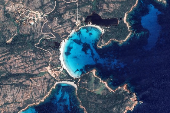
To make the study more concrete, this postdoctoral research will focus on a specific use case: marine anomaly detection, such as the detection of oil spills or sargassum (seaweed) blooms using high-resolution optical imagery.
------------------------
This subject tackle following scientific challenges:
1. Multi-Temporal Modelling of Satellite Data:
• Design models that can represent and analyse long sequences of high-resolution images.
• Adapt these models to handle irregular image acquisition, cloud cover, and differences between sensors.
2. Unsupervised and Self-Supervised Learning:
• Develop methods capable of learning useful spatio-temporal representations without annotated data.
• Explore approaches such as contrastive learning, temporal clustering, or generative modelling.
3. Unsupervised Anomaly Detection:
• Create models that can automatically detect abnormal events or changes within long temporal contexts.
• Move beyond simple binary “anomaly/no anomaly” detection to characterize dynamics, extent, and type.
4. Evaluation and Benchmarking:
• Establish robust evaluation metrics for unsupervised anomaly detection.
• Compare the multi-temporal representation learning results on tasks such as detection, segmentation, or classification with baselines that use single images.
• Design dedicated experiments for the marine use case and validate with available data.
------------------------
We propose the following research program:
• Literature Review. Study existing methods for image time-series analysis, unsupervised/self-supervised learning, and unsupervised anomaly detection in remote sensing.
• Method Design. Propose new frameworks for unsupervised anomaly detection in satellite time series.
• Implementation and Experimentation. Implement and test models on high-resolution datasets. Apply the approach to the marine anomaly detection use case (oil spills, sargassum blooms…).
• Evaluation. Assess the models both quantitatively and qualitatively, and compare with existing baselines.
• Dissemination. Publish results in journals and conferences in remote sensing and machine learning.
------------------------
References:
[1] T. Goudemant, B. Francesconi, M. Aubrun, E. Kervennic, I. Grenet, Y. Bobichon and M.Bellizzi, "Onboard Anomaly Detection for Marine Environmental Protection," in IEEE Journal of Selected Topics in Applied Earth Observations and Remote Sensing, vol. 17, pp. 7918-7931, 2024 , doi: 10.1109/JSTARS.2024.3382394
[2] Szwarcman, D., Roy, S., Fraccaro, P., Gíslason, Þ. E., Blumenstiel, B., Ghosal, R., ... & Moreno, J. B. (2024). Prithvi-eo-2.0: A versatile multi-temporal foundation model for earth observation applications. arXiv preprint arXiv:2412.02732.
[3] I. Dumeur, S. Valero and J. Inglada, "Self-Supervised Spatio-Temporal Representation Learning of Satellite Image Time Series," in IEEE Journal of Selected Topics in Applied Earth Observations and Remote Sensing, vol. 17, pp. 4350-4367, 2024, doi: 10.1109/JSTARS.2024.3358066