Mission
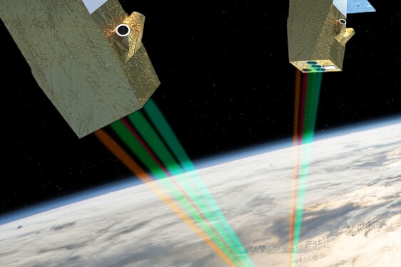
The European Meteosat Third Generation (MTG) geostationary satellite carries the optical Lightning Imager (LI), which covers Europe, the Mediterranean Sea, Africa, part of South America and the Atlantic Ocean. This new sensor just opens a new era in the use of space-borne observations for operational applications: LI observations are delivered to users in a continuous stream less than two minutes after they are measured. These new space-based data enable much more detailed spatio-temporal monitoring of thunderstorms through the detection of electrical activity. This is particularly true given that the occurrence of lightning flashes is closely linked to cloud dynamics and microphysics. Indeed, it is through collisions between ice hydrometeors that the electrification of thunderclouds takes place. Electrical charges are exchanged between hydrometeors, and the transport of hydrometeors in the thundercloud leads to vertically-distributed regions of electrical charges. These regions induce an ambient electrostatic field which, when above a given altitude-dependent threshold, triggers a lightning discharge. The lightning flash either stays in the cloud and is called Intra-Cloud (IC), or connects to the ground (Cloud-to-Ground (CG) flash).
The LI imager detects the light emitted at 777.4 nm by the lightning flashes with a temporal resolution of 1 millisecond. The LI pixel size range from 5 km at nadir and more than 10 km at the edge of LI field-of-view. A lightning flash is then detected as a succession of illuminated pixels close in time and space. LI pixels are gathered in groups (i.e. pixels close in time and space), and groups in flashes according to some time and space criteria.
The thesis will explore the differences in terms of lightning properties and lightning activity features (and cloud properties) over Europe, Africa and the Ocean Atlantic as sensed by LI at both flash and storm scales. It will use the LI flash/group/pixel data made available by EUMETSAT.
The analysis at flash scale will document the typical optical signal radiated during the successive phases of a lightning flash and its temporal, spatial and radiometric properties. Concurrent ground-based lightning observations from long-range (e.g. Météorage) and short-range (e.g. Lightning Mapping Array (LMA)) lightning locating systems will be used to provide additional information on the flash properties (occurrence of ground connections, altitude of triggering,...). For instance, until now, it is not possible to distinguish CG to IC flashes through their optical radiation. Additionally, the properties of the parent convective clouds (e.g. deepening, vertical structure, horizontal extension, ice water path) from coincident space-borne or/and ground-based observations will be used to help interpret the features of the optical lightning signal.
The analysis at storm scale will then document the time and space evolution of the lightning activity through the life cycle of the thunderclouds. This will be conducted by adapting cell tracking algorithms like the ECTA algorithm developed at LAERO/MECANO (Houel et al., 2023, https://doi.org/10.1029/2023EA003354) or the TOOCAN algorithm (Fiollau et al., 2024, https://doi.org/10.5194/essd-16-4021-2024). The electrical cells, their life cycle and their properties (e.g. flash rate, flash density, cell trajectory, cell duration, convection initiation) will then be studied according to the type of convective systems, the regions and seasons of interest. The analysis will be extended to concurrent cloud and precipitation observations delivered by MTG cloud imager and active/passive sensors of low orbit missions, in order to evaluate the pertinence and the performance of the use of lightning observations as a proxy of cloud properties and precipitation through machine learning techniques. Such analysis will be supported by some cloud simulations performed with MesoNH model for a few storm systems well documented by the space-borne missions and ground-based sensors.
The methodologies and the main results of the thesis will be relevant for the French-Israeli mission Cluster for Cloud evolution, Climate and Lightning (C3IEL), and more specifically for a better understanding of the up-coming optical lightning signal that C3IEL imagers will detect, and for contextualizing C3IEL (cloud, water vapor, lightning) observations in the life cycle of the thunderstorms.
The thesis will be carried out within the team Nuages at Laboratoire d’Aerologie (Toulouse, France). It will address some of the team's scientific objectives to be achieved. The thesis will contribute to the scientific activities in preparation for the C3IEL mission.
=================
For more Information about the topics and the co-financial partner (found by the lab!); contact Directeur de thèse - christelle.barthe@cnrs.fr
Then, prepare a resume, a recent transcript and a reference letter from your M2 supervisor/ engineering school director and you will be ready to apply online before March 13th, 2026 Midnight Paris time!
Profile
Infos pratiques
Mot du recruteur
More details on CNES website : https://cnes.fr/fr/theses-post-doctorats